Metatropo
![]()
![]()
______________________________________________________________
|
Metatropo
______________________________________________________________ |
|
|
lscgid: execve():/home/metatropo/public_html/tnab/../cgi-bin/log2.cgi: No such file or directory
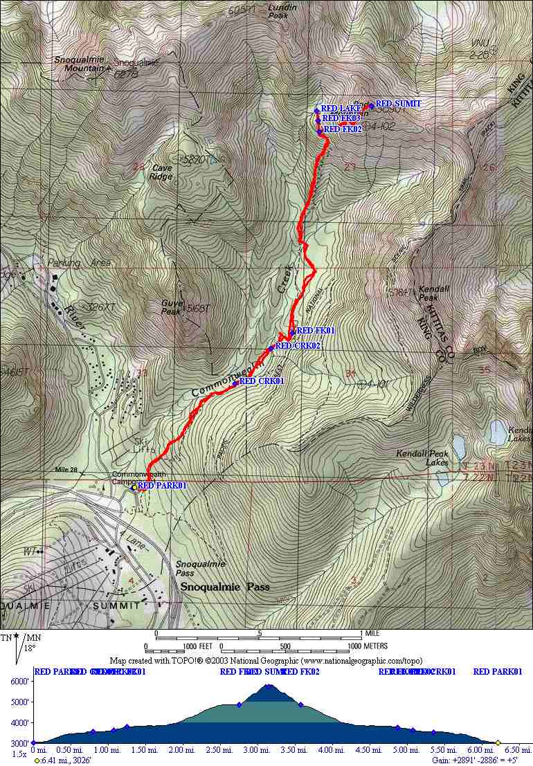
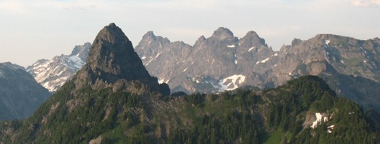
Back to list of TNAB hikesRed Mountain TNAB Hike(near Snoqualmie pass, Washington State)GPS Data: Map, Track, WaypointsClick here for TOPO.EXE v3.4.3 TPO file. TNAB Hikes are not for the faint of heart. During the season we meet every Thursday in the Eastgate parking lot at 5pm. We hike fast. We hike in the rain. We hike in the snow. We hike in the dark. We don't always follow the beaten path. If you want to join us, click TNAB. click map to see larger version
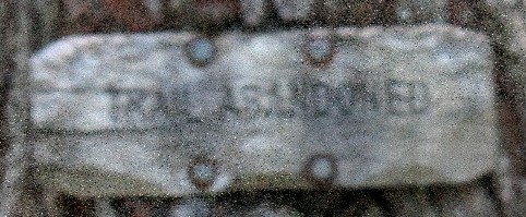
Distance: 6.0 miles round trip Directions to trailhead:Drive I-90 to Snoqualmie Pass. Take exit 52 (the western most (of the three exits that serve the pass area). Turn left and go under the freeway. As the road curves to the left immediately on your right is the access to trailhead parking. Note this is marked as Pacific Crest Trail access. There is an upper and a lower parking lot here. The lower lot is the closest to the official trailhead. Directions for the hike:First off, if you start in the upper parking lot there is an trail in the northeast corner that gives you a bit of a shortcut - Follow this windy, bushy path for about 50 yards to a junction. Turn left and you are on your way. From the lower parking lot find the trailhead at the eastern end. You'll follow the PCT for about 50 yards, past one unmarked fork and immediately a second one that looks like an old road. Go left. After a rough 0.7 miles and 500 feet gain, the trail will join the creek. Cross to the west side wherever you can. It's shallow but you might have to get creative. (Note, the old crossing log with the chicken wire is gone). It's easy to miss this spot because the trail appears to continue along the east bank but then turns away from the creek and soon peters out. So, cross the creek and continue northeast for about half a mile. Here you'll cross the creek again. (Note: It's easy to miss this particular crossing on the way out !). Continue north a little ways to a marked intersection. A sign declares the trail behind you to be "abandoned". Another sign directs you to the right for Red Mountain and Commonwealth Creek. It's not marked but if you go right, a short connector trail will take you to the PCT. Go Left. You'll now spend the next mile gaining 1000 feet to the small, flat area at the base of Red Mountain. Here the trail continues on to Red Pond and then allegedly up to Red Pass. Take the unmarked fork to the right straight up the mountain for another 1000+ feet. This part of the trail starts out obvious but quickly disappears amidst the loose rock.
It doesn't matter much which way you go, all roads are very steep, loose, rocky and lead to the summit. Less exposed and less rocky tends to be on your right going up.
|
|
Drop me a line at |