lscgid: execve():/home/metatropo/public_html/tnab/../cgi-bin/log2.cgi: No such file or directory
Back to list of TNAB hikes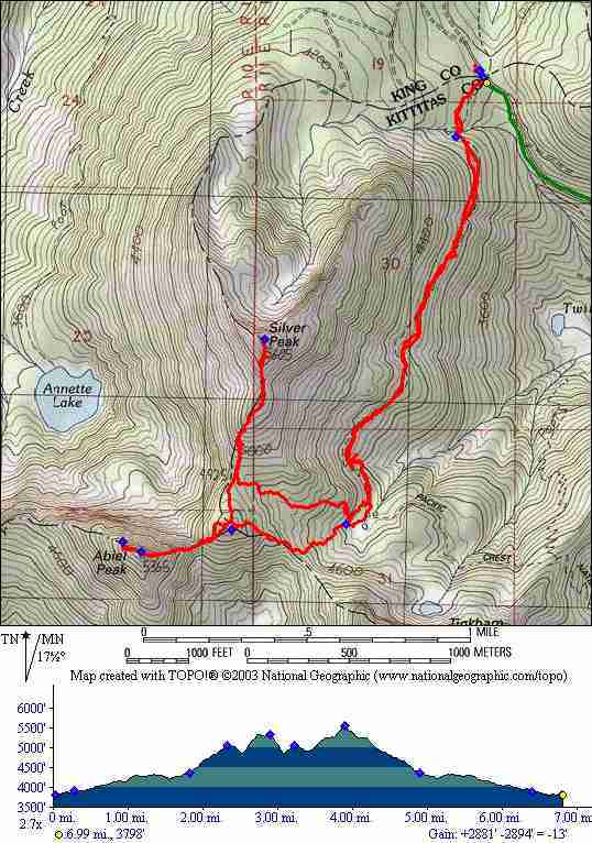
Abiel Peak and Silver Peak TNAB Hike
GPS Data: Map, Track, Waypoints
Click here for
GPS eXchange format file.
The map to the right includes a quick trip to bag the summit of Silver Peak
as well as Abiel Peak. There is an unmarked trail that ascends from the PCT to
the saddle between the two mountains (where our track diverges). There was a lot
of snow and we were forced to do a little bushwacking.
Waypoints:
- Trailhead and parking
- Major creek crossing
- Approx location of fork from PCT to the saddle
- The saddle
- Abiel summit
- Silver summit
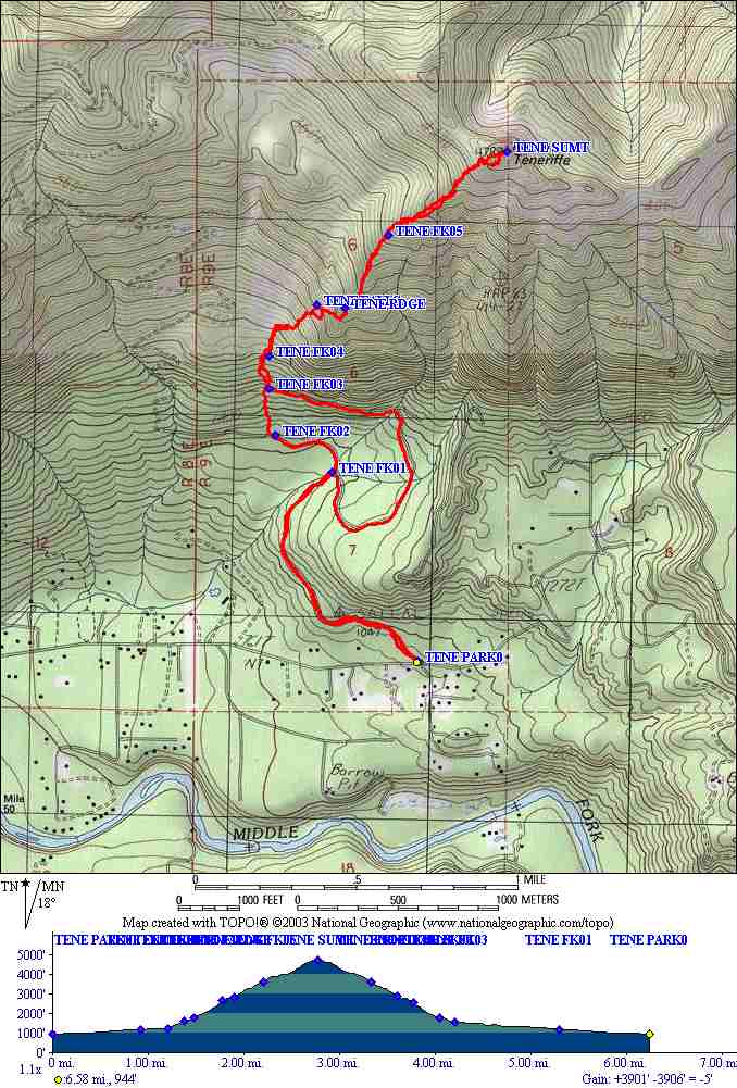
GPS Stats: (includes Silver peak)
- milage: 6.8 miles
- total elevation gain: 2900
- time (2 summits) 5.5 hours
6/29/06: First TNAB hike up Abiel (w/ Silver (and Tinkham))
I don't usually write up TNAB hikes unless they're exceptional. This one
was just that for a number of reasons. First, it was a new hike for our
group. Abiel (pronounced A-B-L) is at the top of Snoqualmie pass and
had a different flavor to it over the other hikes that we do
in the I-90 corridor. The hike starts at Windy Pass - already at 3800 feet
elevation which is way high for an I-90 hike. For a while it
follows the Pacific Crest Trail. The feel is distinctly
more alpine - lots of Pine forest, little creeks and meadows. It's
still a bit early for this hike when we did it - much snow on the trail,
some "testy" snow bridges too - but that's just part of the adventure
and beauty.
We followed the PCT for just under 2 miles although with all the snow it
wasn't clear that we were always on trail. We followed the line of least
resistance... At this point you can see the saddle between Tinkham and Silver
above you. (this point is marked with a waypoint on the map above). Here
we began a relatively easy bushwack 700 feet straight up. There IS a real
trail somewhere around here but it's unmarked (we're told) and we couldn't
find it.

From the saddle you can see your potential goal(s): The Trifecta. Tinkham to the
southeast, Abiel to the west and Silver to the north. We pick
up a faint trail heading toward Abiel that gradually gets better and
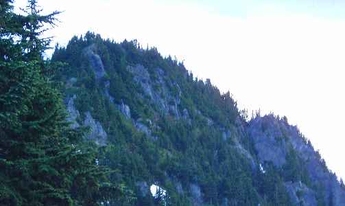
better. The top is a steep hike with a minimal bit of scramble that follows the
edge of the Cedar River watershed. [Note added later - the saddle has a
three-way fork: left to Tinkham, right to Silver and Abiel, straight (down) to
Abiel Lake. If you're hiking to Abiel, head right toward silver and turn left at
a small tarn (I think), go up to a knoll then down to a saddle and up to Abiel.
Tinkham and Silver are pretty straight forward.]
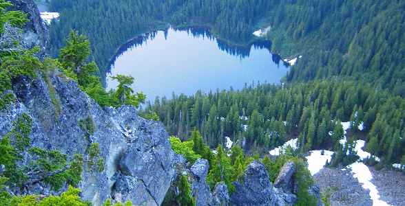
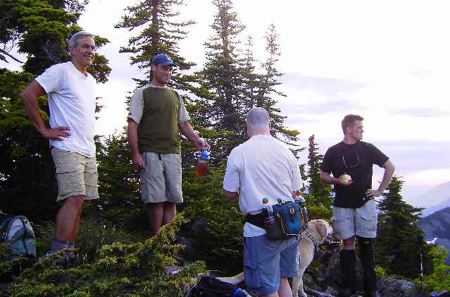
Annette Lake from top of Abiel. TNAB Personnel
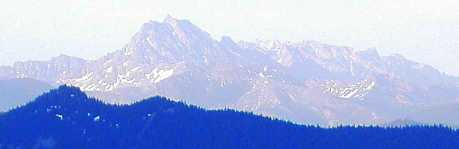
Mt Stuart in the distance
Click here for larger map
Map of the 40 most prominent peaks visible from Abiel Peak
At the summit
we run into John 1 and Jeff who had arrived earlier and already bagged
the top of Tinkham (w/ John 2)! From here we follow another faint trail about
500
feet further west where a rocky outcrop offers the best views: Annette Lake
a thousand feet below, Humpback and Silver nearby, Granite and McClellan, Mt
Stuart and
innumerable other peaks to the north. Is that snowy mountain Whitehorse way
way in the distance ?!
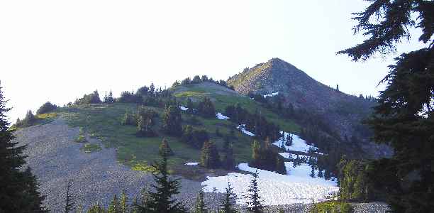
The meadows and talus of Silver Peak look really cool from here. The original
plan was to hit both Abiel and Silver but it's 8:15 PM so we don't have time.
We book time back to the saddle. When Damon and I catch up, Larry and Joan,
Jeff and John 2 have already started down. Mark and John announce that we
ARE going to do Silver. I think at first that they must be kidding but hey,
I'm up for it.
The approach is a fairly quick 600 feet up through "musical" scree followed
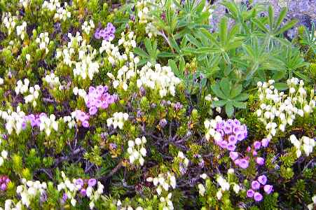
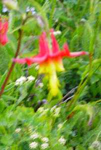
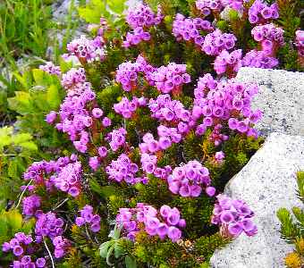
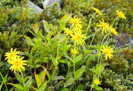
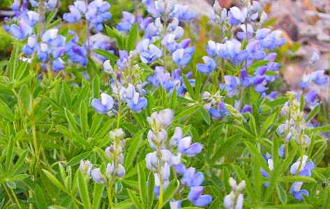
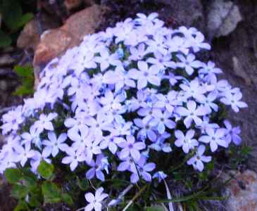
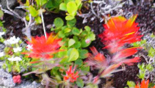
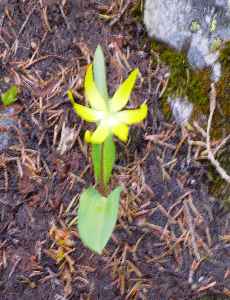
by a gorgeous meadow just bursting with wild flowers to finish on bigger talus,
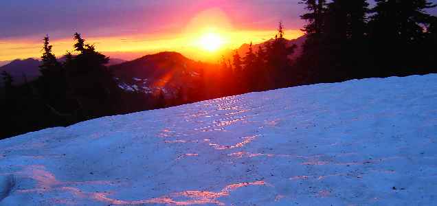
all accented by bits of snow field here and there. The sunset greets us and it
is a beauty! We ponder our options for descent - we're prepared to hike out in
the dark but decide that the most prudent maneuver is to go out the KNOWN way
that we came in.

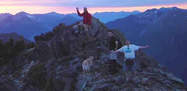
The summit of Silver
We leave the summit at 9:30 PM and cruise the remaining light to the saddle.
Here, in the dark we descend a slightly different line from our up-track - this
part wasn't much fun but once back on the PCT we fly back to join the others
back at the trailhead.
We celebrate some TNAB firsts: a new summit in our quiver (Abiel) and... the
"BI-fecta",
with not one but an appropriate TWO beers apiece. John 1 is the big winner of
the
"trifecta" taking home all three peaks (Tinkham, Abiel and Silver). We enjoy the
stars, tracking satellites, marveling at such a cool hike and throwing rocks at
the croaking frogs in dark (you had to be there).
TNAB Hikes are not for the
faint of heart. During the season we meet every Thursday in the Eastgate parking
lot at 5pm. We hike fast. We hike in the rain. We hike in the snow. We hike in
the dark. We don't always follow the beaten path. If you want to join us, click
TNAB.
|